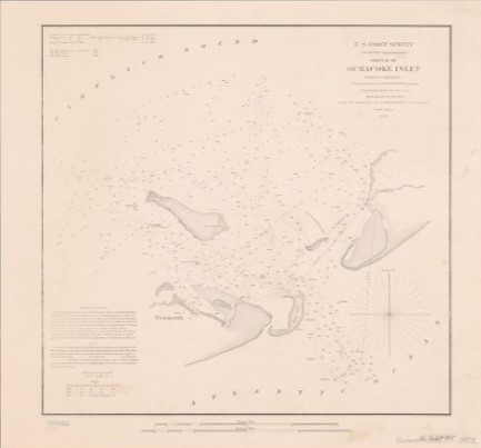
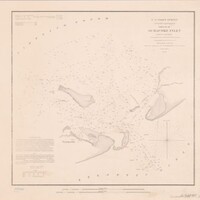
Sketch of Ocracoke Inlet, North Carolina (1852)
Item
-
Title
-
Sketch of Ocracoke Inlet, North Carolina (1852)
-
Description
-
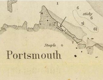
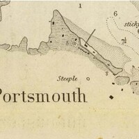
“Sketch of Ocracoke Inlet, North Carolina,” U.S. Coast Survey, 1852, showing symbols for two churches at Portsmouth, and the word Steeple.
-
Creator
-
Alexander Dallas Bache
-
Date
-
1852
-
Identifier
-
Lionel Pincus and Princess Firyal Map Division. Shelf locator: Map Div. 17-663. RLIN/OCLC: 719368880. NYPL Catalog ID (bnumber): b21267966. Folder number: US186.4.05. Universal Unique Identifier (UUID): 27bba2d0-4230-0135-055f-5bddbcaec26f
-
Publisher
-
United States Coast Survey. New York Public Library.
-
Rights
-
The New York Public Library believes that this item is in the public domain under the laws of the United States, but did not make a determination as to its copyright status under the copyright laws of other countries. This item may not be in the public domain under the laws of other countries. Though not required, if you want to credit us as the source, please use the following statement, "From The New York Public Library," and provide a link back to the item on our Digital Collections site. Doing so helps us track how our collection is used and helps justify freely releasing even more content in the future.
-
Source
-
Lionel Pincus and Princess Firyal Map Division, The New York Public Library. "Sketch of Ocracoke Inlet, North Carolina" New York Public Library Digital Collections.
-
Source Link
-
Subject
-
Nautical charts -- North Carolina -- Ocracoke Inlet, Nautical charts, Ocracoke Inlet (N.C.), Atlantic Ocean -- Ocracoke Inlet (N.C.).