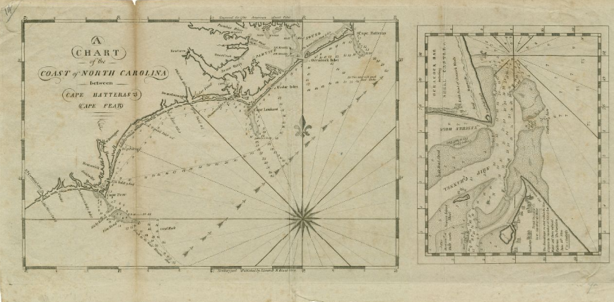
A chart of the coast of North Carolina between Cape Hatteras & Cape Fear (1809)
Item
-
Title
-
A chart of the coast of North Carolina between Cape Hatteras & Cape Fear (1809)
-
Description
-
One inset map: "Ocracock Bar including Shell Castle." Depths shown by soundings and stippling. Includes some comments on the sea floor and inlets. The inset map includes inland illustrations.
-
Creator
-
Edmond M. Blunt
-
Date
-
1809
-
Identifier
-
UNC Chapel Hill Library. Local Identifier FFCC912 C84 no. 14. OCLC 39311345.
-
Language
-
English
-
Publisher
-
UNC Chapel Hill
-
Rights
-
No Copyright - United States
-
Source
-
University of North Carolina at Chapel Hill Digital Collections Repository.
-
Source Link
-
Subject
-
North Carolina
 Portsmouth 1809 Map.png