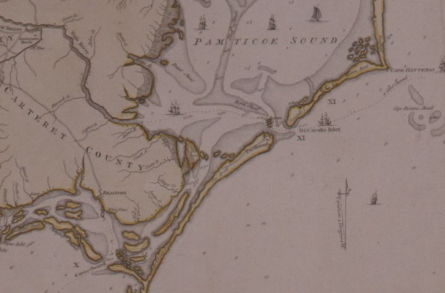
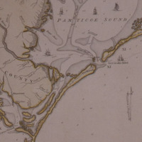
Mouzon Map (1775)
Item
- Title
- Mouzon Map (1775)
- Description
- a-b. Mouzon Map (1775) An accurate map of North and South Carolina, with their Indian frontiers, . . . by Henry Mouson (sic) and others. Printed. Map Collection
- Creator
- Henry Mouzon
- Date
- 1775
- Identifier
- ECU Digital Collections Local Identifier MC0016-s1
- Language
- English
- Rights
- This item has been made available for use in research, teaching, and private study. Researchers are responsible for using these materials in accordance with Title 17 of the United States Code and any other applicable statutes.
- Subject
- North Carolina--Administrative and political divisions--Maps--Early works to 1800, South Carolina--Administrative and political divisions--Maps--Early works to 1800, Harbors--South Carolina--Beaufort--Maps--Early works to 1800, Harbors--South Carolina--Charleston--Maps--Early works to 1800, Sea Islands--Maps--Early works to 1800, South Carolina--Maps--Early works to 1800, North Carolina--Maps--Early works to 1800
- Type
- Maps
- Item sets
- Portsmouth Island Items
- Site pages
- Home
- Media
 Portsmouth 1775 Map.png